Subject: Texas
Period: 1930-51 (circa)
Publication:
Color: Printed Color
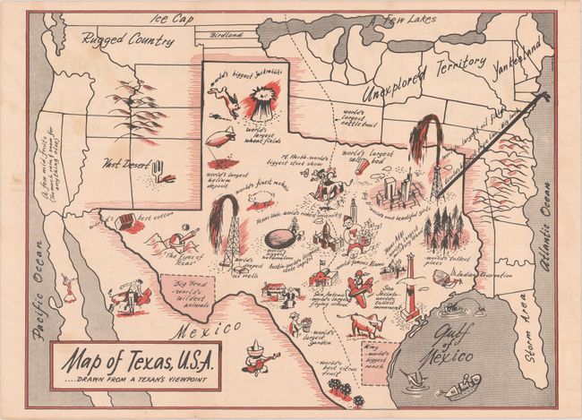
A. Map of Texas, U.S.A..... Drawn from a Texan’s Viewpoint, by Texas Highway Department, circa 1950 (11.5 x 8.6"). This humorous map of North America was drawn with a vastly oversized Texas occupying approximately half of the United States, similar to the "Official Texas Brags Map" of 1948 on a smaller scale. Includes numerous vignettes within the state including "world's biggest jackrabbits", "world's largest oil field" and "Big D - world's most beautiful girls." Areas outside of Texas include "Storm Area", "Unexplored Territory", and "Yankeeland." Self-folding (4.3 x 9.0") with related text on verso. There are no past sales records and only one institutional example located on OCLC. Condition: Issued folding with a few light stains at left. (B+)
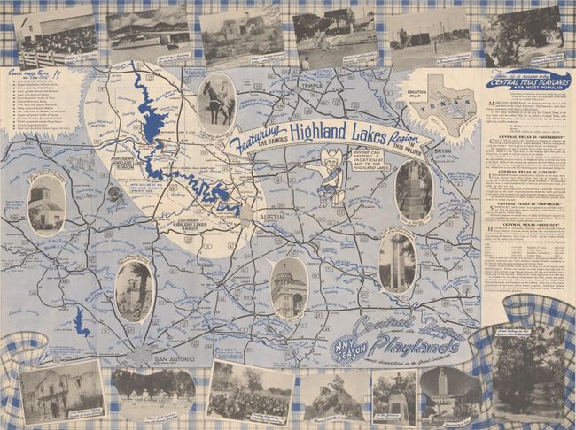
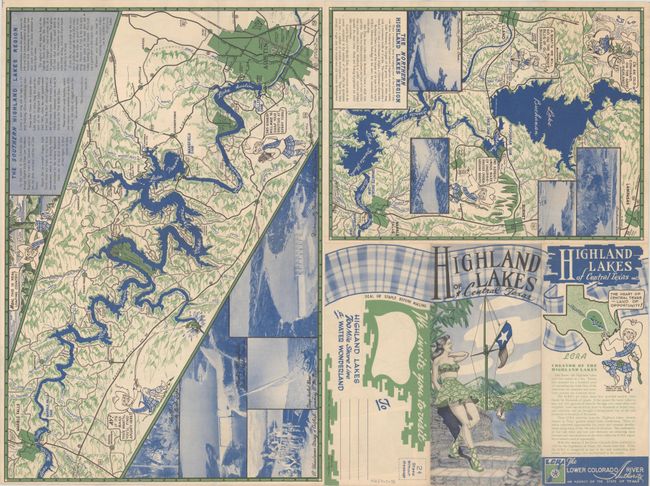
B. Highland Lakes of Central Texas, by Art Anderson, dated 1951 (24.0 x 18.1"). There are three maps within this promotional brochure. On recto is the large "Central Texas and its Colorful Playlands" (18 x 24") that shows the area from San Antonio to Austin and Temple with the Highland Lakes highlighted in white. Includes numerous photo illustrations around the map. On verso are maps of "The Southern Highland Lakes Region" (11.8 x 17.5") and "The Northern Highland Lakes Region" (11.5 x 8.4"). Both maps with “Tex McLoch Symbol of the Highland Lakes” providing cartoon humor. Self-folding (4.2 x 9.0"). Two examples located on OCLC. Condition: A clean and colorful example, issued folding. (A)
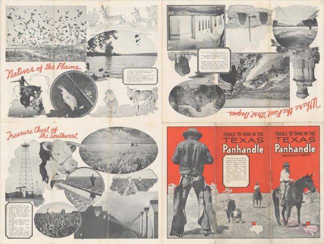
C. Where to Go and What to See in the Texas Panhandle, circa 1930 (22.9 x 16.9"). An unusual pictorial map of the panhandle filled with illustrations representing the region including cattle ranches, oil derricks, cowboys, and more. Flanked by panels of text and a hieroglyphics border. The verso is filled with illustrations including a striking 3-panel cover illustration of cowboys in action. This map was published by the Chamber of Commerce departments of the various towns located in the Texas panhandle. Self-folding (4.0 x 9.0"). One example located on OCLC. Condition: Issued folding with a few light stains and several tiny splits at the fold junctions. Stamped on the front wrapper. (B+)
References:
Condition:
See description above.