Subject: Texas
Period: 1846-67 (dated)
Publication:
Color: Hand Color
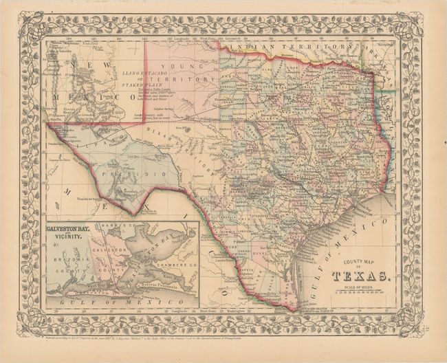
A. County Map of Texas, from New General Atlas, dated 1867 (13.6 x 10.9"). This is one of the most attractive commercial atlas maps of the state of Texas, inset with a map of Galveston Bay and it vicinity. West Texas is made up of Young Territory, Bexar Territory and El Paso and Presidio counties. The map clearly shows the Llano Estacado or Staked Plain with a notation about the region being "destitute of both wood and water." Trails and roads are shown and limited railroads extend only into Austin. The map is surrounded by a finely engraved leaf and grapevine border. While the map is dated 1867, Dawson county still appears just south of Bexar Territory, despite the fact that it had been abolished in 1864. Condition: Contemporary color with a hint of toning. (A)
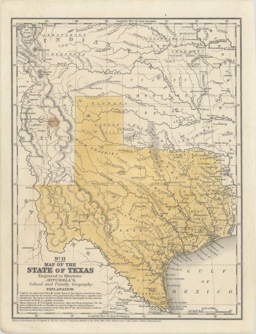
B. No. 13 Map of the State of Texas Engraved to Illustrate Mitchell's, School and Family Geography, from Mitchell's School and Family Geography, dated 1846 (7.9 x 10.3"). This map features an early rending of the final borders of the new State of Texas. This is from the series that was the first to name Dallas. Indian tribes, forts, wagon roads, mines and more are noted. The Alamo is located as Ft. Alamo. County development has extended to about 99° N. latitude at Gonzales and Gollard counties. The map is dated 1846, but it was likely published closer to 1848. Condition: There is a small stain at left. (B+)
References:
Condition:
See description above.