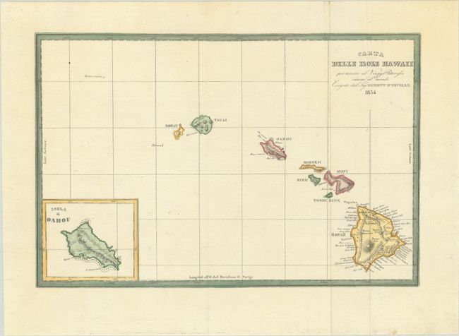
Subject: Hawaii
Period: 1834 (dated)
Publication:
Color: Hand Color
Size:
12.7 x 8.4 inches
32.3 x 21.3 cm
A fine chart of the Hawaiian Islands with an inset of the Isola di Oahou. Dumont d'Urville circumnavigated the globe for the second time between 1826 and 1829. On this expedition his accomplishments included significant Pacific discoveries. His records were so detailed that for the first time the scattered islands of the South Pacific could be divided into three major groups: Melanesia, Polynesia and Micronesia. Although the expedition did not pass through Hawaii, this map is interesting as it is a very early use of the native name Hawaii for the entire island chain. Published in an Italian edition of Dumont d'Urville's Voyage Pittoresque autour de Monde.
References:
Condition: A
A bright sheet, issued folding and now flattened with a couple of tiny spots.