Catalog Archive
Auction 180, Lot 241

"A New Map of Connecticut from the Best Authorities", Payne, John

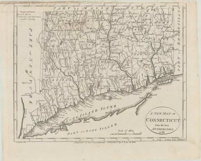
Subject: Connecticut

Period: 1799 (dated)

Publication: New and Complete American Encyclopedia

Color: Black & White

Size:
9.3 x 7.4 inches
23.6 x 18.8 cm
Download High Resolution Image
(or just click on image to launch the Zoom viewer)

This early map of Connecticut and Long Island Sound is filled with detail on the early counties, towns, and roads. The courthouses and places of worship are denoted by small buildings and circles, respectively. Engraved by Alexander Anderson and published by J. Low. This originally appeared in Payne's New and Complete Universal Geography, but this state appeared in Low's New and Complete American Encyclopedia, published from 1805 to 1811.

References: Thompson #44; cf. Wheat & Brun #292.

Condition: B+

There is minor soiling and some tiny chips in the map's border at top that have been mostly repaired on verso with archival materials.

Estimate: $150 - $180

Sold for: $110

Closed on 11/18/2020

Archived