Subject: Los Angeles, California
Period: 1920-22 (circa)
Publication:
Color:
A nice pair of early 20th century maps of Los Angeles County:
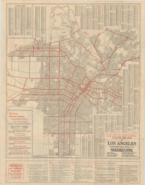
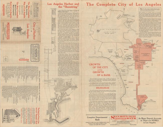
A. Map of the City of Los Angeles Published Exclusively by Security Trust & Savings Bank, by the Clason Map Co., dated 1920, printed color (20.4 x 23.5"). A detailed street map approximately covering the area from Inglewood north to Griffith Park and west to Hollywood. Locates four branch offices of the bank along with red lines indicating the best connecting streets. The verso contains interesting maps showing the "shoestring" addition to Los Angeles Harbor, and another showing the growth of the city through annexation. Condition: There are a few tiny splits at the fold junctions and some minor staining along the right border.
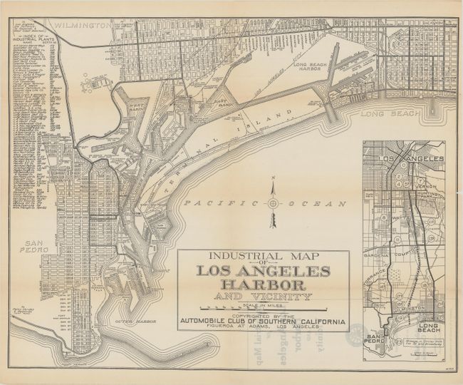
B. Industrial Map of Los Angeles Harbor and Vicinity, by Automobile Club of Southern California, circa 1922, black & white (19.9 x 15.7"). This map features San Pedro and Long Beach and details the numerous industrial companies who occupy the inner harbor. A table at left lists the various company names and the associated berth numbers. An inset map at right shows the driving distances from downtown to points south including San Pedro and Long Beach. Condition: There is a hint of toning along the fold lines and several small fold separations that have been closed on verso with archival tape.
References:
Condition: B+
Issued folding. See description above.