Subject: San Francisco, California
Period: 1926 (dated)
Publication:
Color: Printed Color
Size:
25.4 x 21.1 inches
64.5 x 53.6 cm
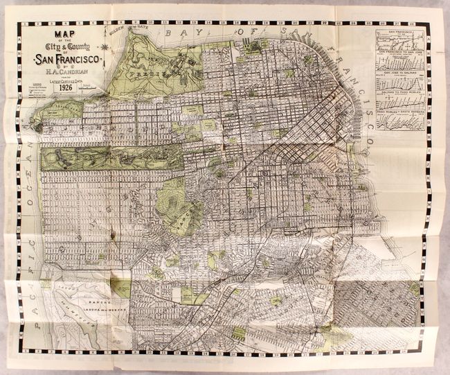
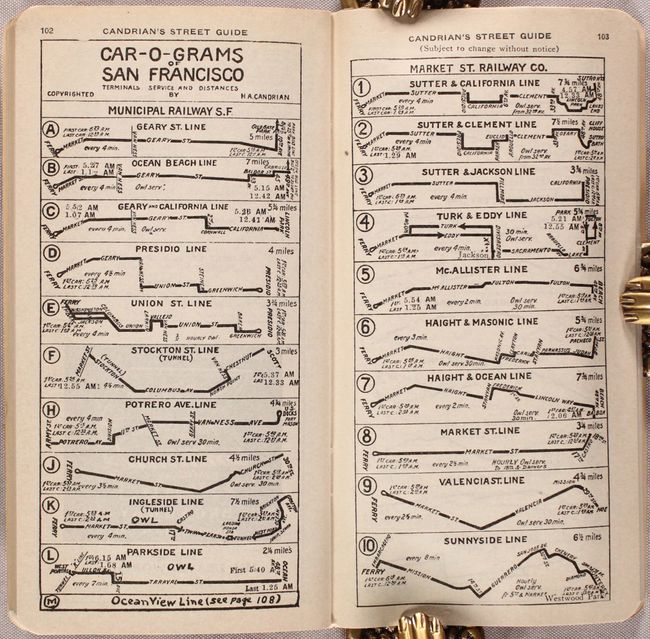
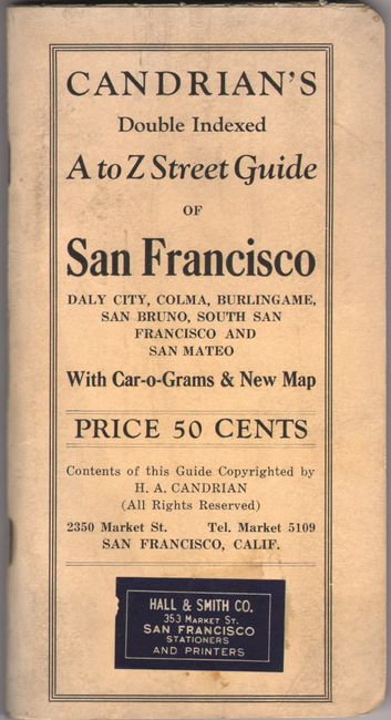
An attractive early 20th century map of the city by H.A. Candrian showing the street grid pattern, neighborhoods, parks, and cemeteries. Locates the Presidio, Golden Gate Park, and China Basin with a legend further identifying street car lines, railroads, bus lines, and elevation. The verso contains a large map of San Mateo. The 127 pages of accompanying text is primarily a street index, but also includes seven pages of “Car-o-Grams” displaying the various street car lines. Candrian was especially proud of the map, and dedicated a full page to commend the printer, commenting that “the work done [on the map] was the best we have ever had.” No past sales records of institutional examples located for this 1926 edition. 12mo., cream paper wrappers.
References:
Condition: B+
The map is very clean and bright with five fold separations ranging in size between 1-3". Text is clean and tight. Covers have minor wear and light soiling.