Subject: Arizona
Period: 1908 (dated)
Publication:
Color: Printed Color
Size:
16.9 x 20.3 inches
42.9 x 51.6 cm
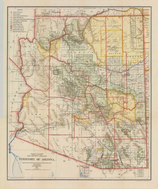
A colorful and detailed map issued four years before statehood. The map details the extent of National Forests (not Forest Reserves as on previous editions), Indian Reservations, Military Reservations, and Private Land Grants. It also includes the new categories of National Monuments and National Game Preserves. There is good detail of the large number of railroads of the day. The large extent of the Grand Canyon Forest Reserve and National Park is delineated. The use of brilliant colors gives this map a vibrant visual impact. Compiled and drawn by Daniel O'Hare.
References:
Condition: A+
Clean and bright, issued folding with a binding trim in the left blank margin.