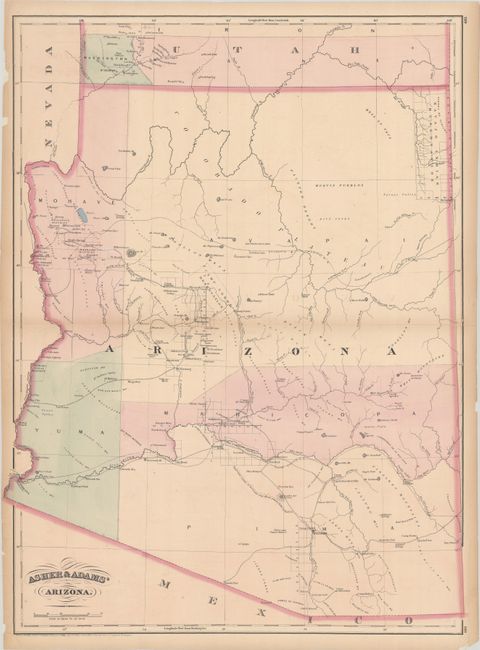
Subject: Arizona
Period: 1874 (dated)
Publication: New Commercial, Topographical, and Statistical Atlas and Gazetteer of the United States
Color: Hand Color
Size:
17 x 22.8 inches
43.2 x 57.9 cm
This map shows Arizona Territory a decade after it became a territory. There are five very large counties (Yavapai, Yuma, Mojave, Pima, and Maricopa) with most of northern Arizona shown as Indian country outside of Prescott. The capital is correctly shown to be Tucson. The map displays major rivers, numerous mines, military, and Indian reservations, and the progress of public surveys. It also depicts a few key roads and two proposed east-west rail lines across the territory. A small Navajo Reservation is noted in the northeast corner. Asher & Adams' atlas was one of the first United States atlases to concentrate on transportation networks, showing minimal topography.
References: Rumsey #0041.041.
Condition: B+
Contemporary color on a sheet with light toning along the centerfold and edges. The sheet is backed in archival tissue, closing several edge tears.