Subject: Arizona Territory
Period: 1857-58 (dated)
Publication: Wagon Roads... A Report Upon the Several Roads Constructed...
Color: Black & White
Size:
36.5 x 22.4 inches
92.7 x 56.9 cm
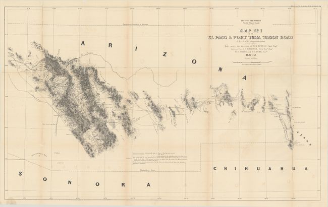
In 1857, the U.S. Congress passed the Pacific Wagon Road Act, allowing the survey and construction of wagon roads. Issued as part of Albert Campbell’s Wagon Roads... A Report Upon the Several Roads Constructed, this map details the section of the important southern route between El Paso and the Pima villages near present-day Phoenix. This road improved Cooke’s Road with several shortcuts. The map provides explicit detail including springs, tanks, camps, mail stations, forts, Indian villages and ruins, missions, mines, old roads, and trails. Of particular interest is the proposed boundary designating the territory of Arizona in the southern portion of New Mexico Territory. This is the only government published map to show this configuration, all others being commercial publications. Much of the information on the map is derived from maps from the Mexican Boundary Commission.
References:
Condition: B
Issued folding, now professionally backed with Japanese tissue repairing several separations and small areas of loss along the folds. There is light toning along the folds, minor offsetting, and a small stain that just crosses the neatline at bottom left.