Subject: Southwestern United States, Colona
Period: 1855 (dated)
Publication: Colton’s General Atlas
Color: Hand Color
Size:
15.8 x 12.9 inches
40.1 x 32.8 cm
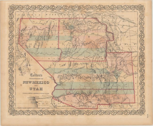
This is one of the scarcest and most sought after editions of Colton's map of the Southwest. It is the only regional atlas map to show Colona, the proposed territorial name for what would become Colorado Territory in 1861. The entire map depicts transitional territorial boundaries. The proposed territory of Arizona appears below New Mexico delineated by a dashed line at 33.5° N just below Socorro. An early Nevada Territory appears in an ephemeral shape carved out of the large Utah Territory with its eastern border along the 114° W to Pruess Lake then wandering south-south-east to form a boundary along the Spanish Trail. Massive territorial counties stretch from California to Texas and the Rocky Mountains. Early explorer’s routes are shown, including those of Conde & Bartlett, Kearny, Fremont, Stansbury, Washington, and Gunnison (with the place where he was killed by Indians noted). Further east is part of Kanzas and Nebraska. Also depicted are forts, military posts and early US mail routes. Surrounded by Colton's distinctive scroll border. Dated 1855, and published circa 1859.
References:
Condition: B
Contemporary color with light uneven toning and scattered foxing.