Catalog Archive
Auction 180, Lot 196

"Map of Reconnaissances of Routes in and Leading from the Department of the Platte", U.S. Corps of Engineers

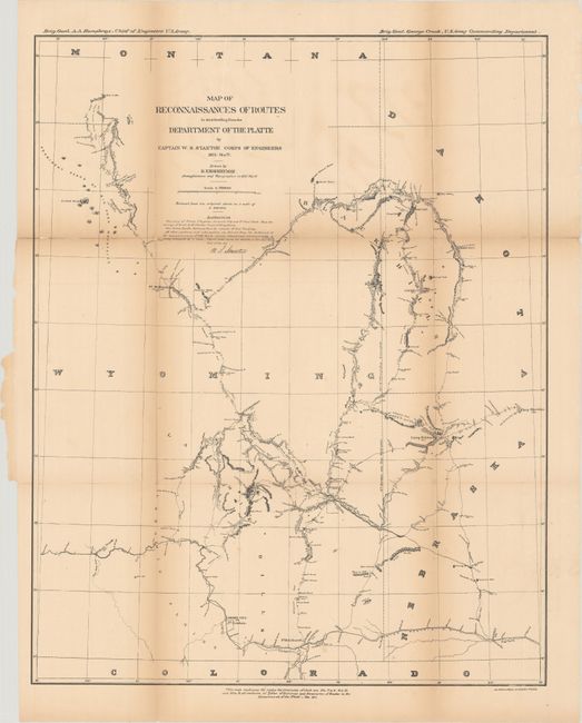
Subject: Western United States, Wyoming

Period: 1877 (dated)

Publication: Annual Report of the Chief of Engineers

Color: Black & White

Size:
18.8 x 23.6 inches
47.8 x 59.9 cm
Download High Resolution Image
(or just click on image to launch the Zoom viewer)

This detailed map was reduced from six sheets to one and covers eastern Wyoming, western Nebraska and South Dakota, and southeastern Montana just past the Tongue River. It shows Captain William Stanton's fourteen different reconnaissances from 1875-77 which included stops at Deadwood, Hat Creek, Fort McKinney, Custer City, Camp Robinson and many more. Wheat notes that the Montana portion of the map includes dates from June 1876, reflecting Crook's operation against the Sioux. Drawn by R.E. Koehnemann, Draughtsman and Topographer.

References: Wheat (TMW) #1291.

Condition: B

Issued folding and now flattened and backed with tissue to repair several small fold separations. There is light toning along the fold lines.

Estimate: $140 - $170

Sold for: $100

Closed on 11/18/2020

Archived