Subject: Western United States, Texas
Period: 1846 (published)
Publication:
Color: Hand Color
Size:
20.5 x 22.4 inches
52.1 x 56.9 cm
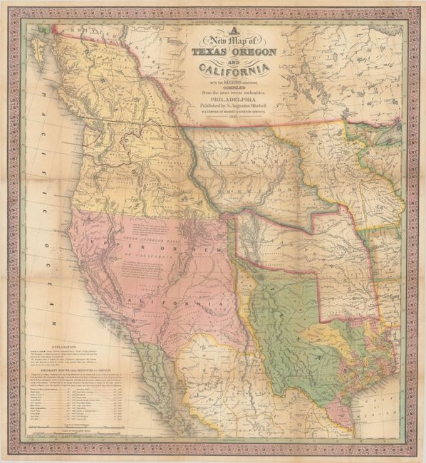
Mitchell's seminal 1846 pocket map of Texas, Oregon Territory, Upper California, Missouri Territory, Iowa Territory, and Indian Territory is one of the most important and desirable maps in a collection of Western Americana. It was one of the first separately issued, commercial maps to concentrate of the West after the annexation of Texas in 1845 and the beginning of the Mexican-American War in 1846.
During the 1840s there was tremendous interest in understanding the landscape of the West given Texas' recent statehood. Mitchell capitalized on this interest by publishing one of the earliest maps to show the newly formed state. The map provides a snapshot of the most current geographical knowledge of the West. Mitchell’s sources included Arrowsmith’s 1841 map of Texas, Lewis & Clark’s expedition, Nicollet’s map of the region between the Mississippi and the Missouri rivers, Fremont and Emory’s explorations, and Wilkes’ map of the Oregon territory. The map was so esteemed that Lieutenant Emory wrote that it was one of only three maps he thought was worthwhile to carry along when he left Washington in June of 1846 to serve with the Army of the West (the others being Gregg's and Albert's).
Cartographically, the stovepipe configuration shows Texas's northern claim all the way to the 42nd parallel in present day Colorado, following Emory's map, and includes the state's claim to the Upper Rio Grande in present-day New Mexico. These claims were eventually given up in the Compromise of 1850 in exchange for the federal assumption of Texas' public debt. The map displays a large Oregon territory with the northern border well into British Colombia, reflecting United States interests. Large, early configurations of Missouri Territory, Indian Territory and Iowa are also depicted. The Gold Region of California is identified, along with the Oregon Route and the Caravan Route to Santa Fe. The map is filled with information on Indian tribes, rivers, topography and notations regarding the Great Basin. At bottom left is a distance table for places along the Emigrant Route.
Mitchell’s map was very popular when issued due to general interest in the new state of Texas as well as the Mexican-American war. It is one of the most important maps of the period of westward expansion into the American Frontier.
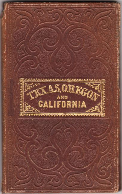
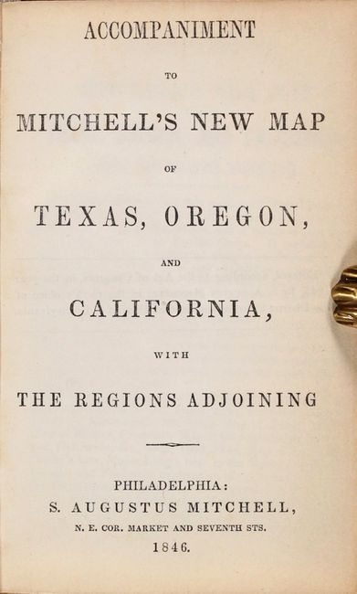
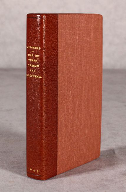
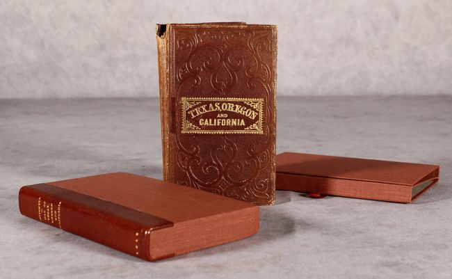
The lot includes the original 46-page booklet entitled Accompaniment to Mitchell's New Map of Texas, Oregon and California. The text describes each territory and state with notes on several early explorations. According to Wheat, “The Accompaniment is of particular interest, containing perhaps the clearest statement of Oregon and California facts that came out of the period just prior to settlement of the former's boundaries and inclusion of the latter in the United States." This original 16mo gilt-lettered roan booklet is enclosed in a fine clam-shell box with a leather spine featuring gilt titling. The front endpaper bears the book plate of Frederick Woodward Skiff (1868-1947), a collector and dealer of rare books and Americana, based in Portland, Oregon.
References: Cohen (Mapping the West) pp. 134-35; Howes #M685; Martin & Martin #36; Wheat (TMW) #520; Wheat (Gold) #29.
Condition: B+
Contemporary color. Issued folding, now professionally backed with Japanese tissue, repairing some small splits at the fold junctions with minute loss of image. There is light toning primarily along the fold lines. The booklet has light shelf wear and a couple small chips to the spine.