Subject: Southern United States, Civil War
Period: 1862 (dated)
Publication:
Color: Hand Color
Size:
24.4 x 24.3 inches
62 x 61.7 cm
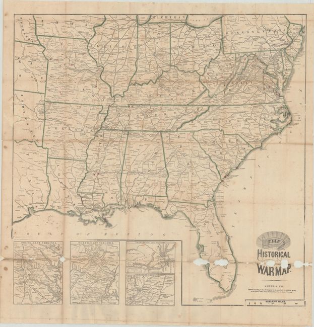
This is Asher's superb and scarce pocket map of the region involved in the Civil War, locating battle sites through July of 1863. The map covers the general area of the war showing towns, railroads, waterways and forts. State boundaries are colored green and battle sites are located with a red overprinted circle. Includes insets of South-East Virginia, North-East Virginia, Charleston and Vicinity, and Vicksburg and Vicinity. Folds into brown boards with 72 page "Rebellion Record" containing a fascinating contemporary view of the war including four small battle plans. Issued by Mack R. Barnitz in Cincinnati, Ohio.
References: cf. Stephenson #22.
Condition: C+
Issued folding and now flattened and backed with tissue to repair and reinforce numerous small separations along the fold lines. There are several areas of small loss along the bottom fold along with scattered foxing. Covers are lightly worn and stained.