Subject: World
Period: 1810 (circa)
Publication:
Color: Hand Color
Size:
21.6 x 16 inches
54.9 x 40.6 cm
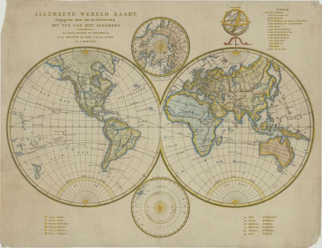
This uncommon Dutch double-hemisphere world map was drawn and engraved by Cornelis van Baarsel. It features relatively sparse inland information, identifying only nations or territories of note, some major cities, and defining topographical details. In North America, the United States are confined to east of the Mississippi, with massive Louisiana and New Mexico territories west of the river. New York, Philadelphia, Washington, D.C., Baltimore, Charleston, and Santa Fe are the only cities named in the present-day United States. Smaller maps of the poles appear between the hemispheres. An armillary sphere with a key appears at top right. The signs of the Zodiac are shown at the bottom. Published by Mortier, J.H. de Lange, and J. Oomkens.
References:
Condition: B+
On a lightly toned sheet with a Strasbourg bend-and-lily watermark. There are some manuscript notations in the map image, some tiny separations along the centerfold, and minor soiling, much of it confined to the margins. A short centerfold separation and tear at bottom have been closed on verso with archival tape.