Subject: Maryland & Delaware
Period: 1801 (published)
Publication: Carey's American Pocket Atlas
Color: Black & White
Mathew Carey was a seminal figure in early American publishing; establishing the first publishing firm to specialize in cartography and issuing the first atlas devoted exclusively to American maps. He set up an elaborate cottage system of craftsmen for compiling, engraving, printing, and coloring maps. This practice was emulated by later American cartographic publishers such as John Melish and Henry S. Tanner. The American Atlas concept was also adopted by other publishers in both the United States and Europe.
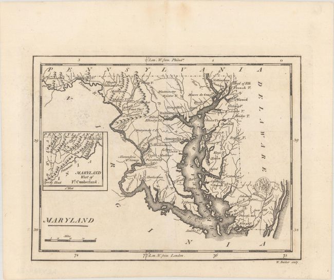
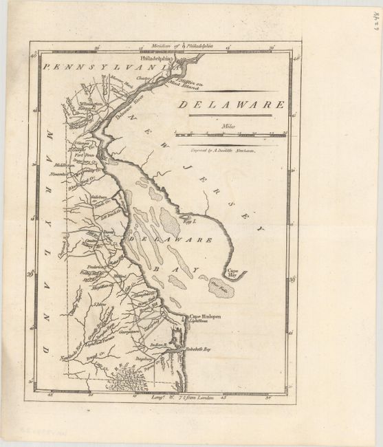
A nice pair of early maps showing the river systems, bays, topography, and a number of place names. Both maps are in the second state and include the delineation of important roads and additional place names that were not on the 1796 edition including the District of Columbia on the Maryland map. Engraved by William Barker and Amos Doolittle respectively.
A. Maryland (7.7 x 5.8").
B. Delaware (5.8 x 7.6").
References: Wheat & Brun #513 & #485.
Condition: A
Crisp impressions on clean sheets with a hint of offsetting.