Catalog Archive
Auction 180, Lot 154

NO RESERVE

"County Map of the States of New York, New Hampshire, Vermont. Massachusetts, Rhode Id. and Connecticut", Mitchell, Samuel Augustus

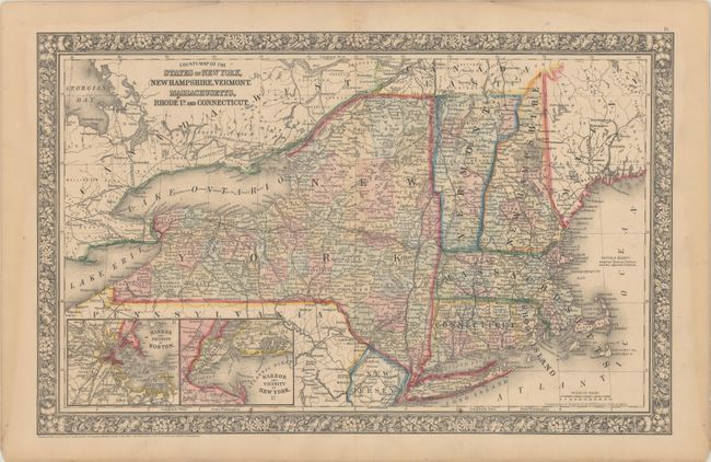
Subject: New England - United States

Period: 1860 (dated)

Publication:

Color: Hand Color

Size:
21.3 x 13.4 inches
54.1 x 34 cm
Download High Resolution Image
(or just click on image to launch the Zoom viewer)

Bordered by Canada in the East and West, Maine, Pennsylvania, New Jersey and the Atlantic Ocean, this lovely map is an excellent portrayal of the extent of settlement at the time. With insets of the Harbor and Vicinity of Boston and the Harbor and Vicinity of New York. There is very detailed information on cities, counties, railroads and canals. Decorative floral borders.

References:

Condition: A

Original color with light toning along the edges of the sheet.

Estimate: $60 - $80

Sold for: $75

Closed on 11/18/2020

Archived