Catalog Archive
Auction 180, Lot 15

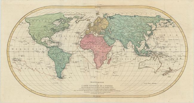
"Mappe Monde ou Carte Generale de l'Univers sur une Projection Nouvelle d'une Sphere Ovale pour Mieux Entendre les Distances Entre l'Europe et Amerique...", Lotter, Mathias Albrecht

Subject: World

Period: 1778 (dated)

Publication:

Color: Hand Color

Size:
37 x 18.8 inches
94 x 47.8 cm
Download High Resolution Image
(or just click on image to launch the Zoom viewer)

This is the rare first edition of this very large and impressive world map on an oval projection. It is based on D'Anville's wall map of 1761 and was updated to include the recent discoveries of Captain Cook. It delineates the course of Cook's first voyage. In North America, a conjectural River of the West is traced. Greenland appears as a narrow peninsula attached to the rest of the peninsula. Alaschka is a slim finger-like island reaching across the Bering Strait. Terre de la Compagnie is an incomplete coastline to the northeast of I. Jeso. Printed on two joined sheets, as issued.

References:

Condition: A

A nice impression on watermarked paper, issued folding with minor soiling and a couple of printer's creases at bottom right.

Estimate: $600 - $750

Sold for: $450

Closed on 11/18/2020

Archived