Catalog Archive
Auction 180, Lot 100

"A Plan of the River St. Lawrence, from the Falls of Montmorenci to Sillery; with the Operations of the Siege of Quebec",

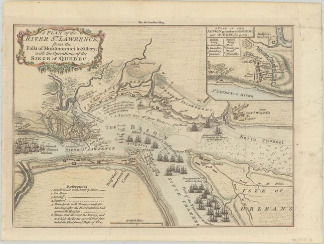
Subject: Quebec City, Canada

Period: 1759 (published)

Publication: London Magazine

Color: Hand Color

Size:
9.6 x 6.9 inches
24.4 x 17.5 cm
Download High Resolution Image
(or just click on image to launch the Zoom viewer)

This is a very detailed map of the Siege of Quebec (1759) during the French & Indian War. The map shows the positions of the two opposing forces with numerous war ships in the river surrounding the city. Admiral Holme's Division is upstream with Admiral Saunder's Division to the east and also up the South Channel. Locates the HMS Centurion in the North Channel just below General Wolfe's land-based camp near the Falls of Montmoreenci. At upper right is a "Plan of the Action gained by the English near Quebec, Sep. 13, 1759." Decorated by a fancy rococo-style title cartouche.

References: Jolly #LOND-178.

Condition: A

Issued folding with a very faint dampstain at top.

Estimate: $140 - $170

Sold for: $600

Closed on 11/18/2020

Archived