Subject: North America
Period: 1793 (circa)
Publication: Le Petit Atlas Moderne
Color: Hand Color
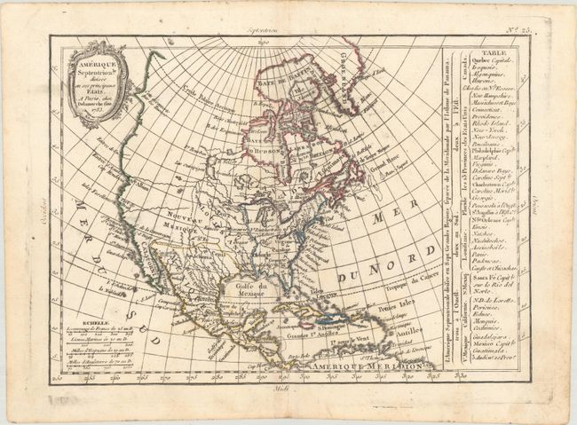
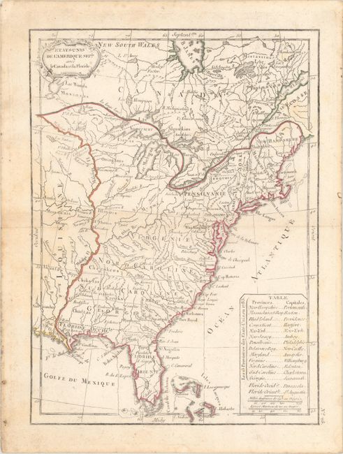
This uncommon pair of maps comes from Delamarche's early school atlas. The first map (9.9 x 7.1") depicts North America and shows the new United States extending to the Mississippi. West of the Mississippi is a large Louisiana Territory and Nouveau Mexique. Santa Fe is named in the west, and Cenis appears in Mexico. The entire Northwest is blank with the exception of a couple of rivers and a notation that the coast was discovered by Russians. There is a table at right that identifies the thirteen states, the remaining possessions of the French, English and Spanish, and tribes on the continent. Although the map is dated 1783, it was published circa 1793. The second map (7.3 x 9.9") focuses on the young United States. Virginia, North Carolina, South Carolina, and Georgia extend to the Mississippi River, and numerous forts and Indian villages are also located. A table in the Atlantic names the 13 states with their capitals. On both maps, the colorist mistakenly places West and East Florida as part of the United States instead of the Spanish possession of Louisiane. Both maps feature rococo-style title cartouches.
References:
Condition: B+
Both maps have contemporary outline color on watermarked paper. The map of North America has a short centerfold separation at bottom that has been archivally repaired, and light soiling, most of it in the blank margins. The map of the United States has light scattered foxing.