Subject: Colonial North America
Period: 1747 (dated)
Publication: An Account of the European Settlements in America
Color: Hand Color
Size:
8.1 x 6.1 inches
20.6 x 15.5 cm
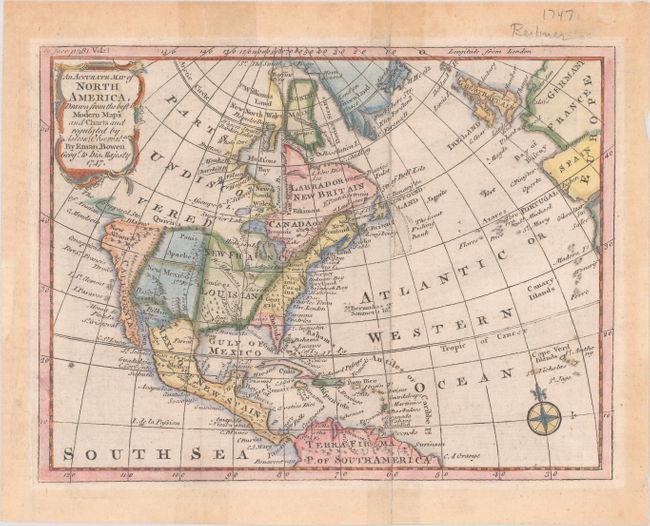
This copper engraved map was the frontispiece to Vol. II of Edmund Burke's An Account of the European Settlements in America. The map extends to include all of the Caribbean Islands. New France and Louisiana occupy the Midwest; western Canada is labeled 'Parts Undiscovered'. Santa Fe and several Indian tribes are located in the Southwest. The Northwest Passage is hinted with an unclosed "Supposed Str. Of Annian." The Colorado River is named and correctly flows into the Sea of Cortez. In Texas is Senis Tekas. Great Britain and part of Europe are seen at right. Fancy rococo-style title cartouche and compass rose embellish this compact map.
References: Sabin #9282.
Condition: B+
Issued folding with old color, mat burn confined to the blank margins, and short fold separations at top and bottom closed on verso with cello tape.