Subject: Atlases
Period: 1694 (published)
Publication:
Color: Black & White
Size:
6.6 x 8.1 inches
16.8 x 20.6 cm
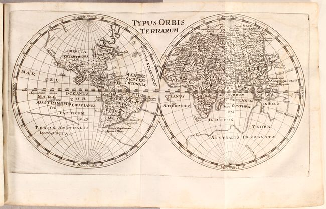
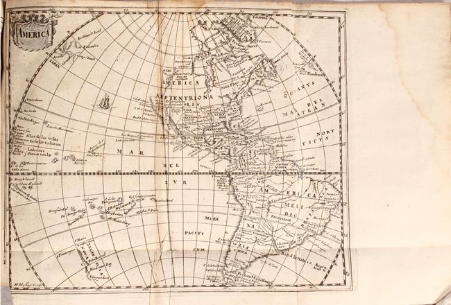
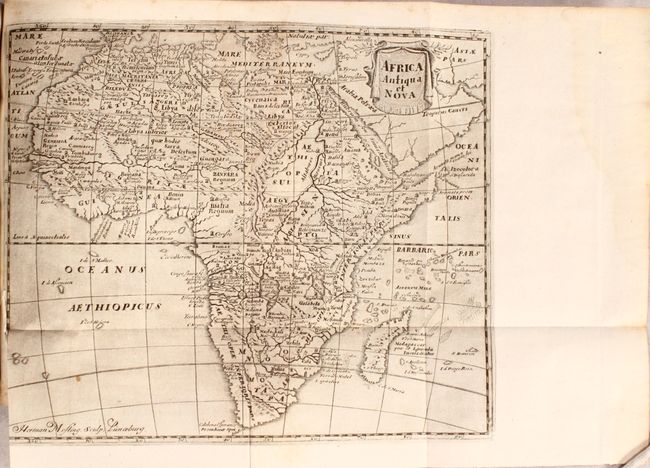
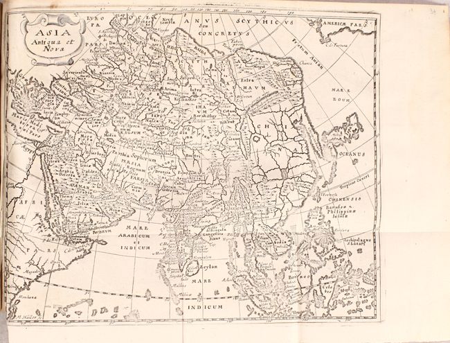
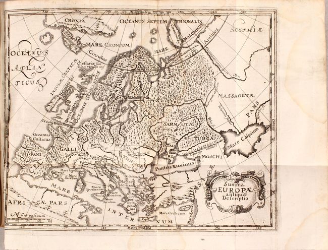
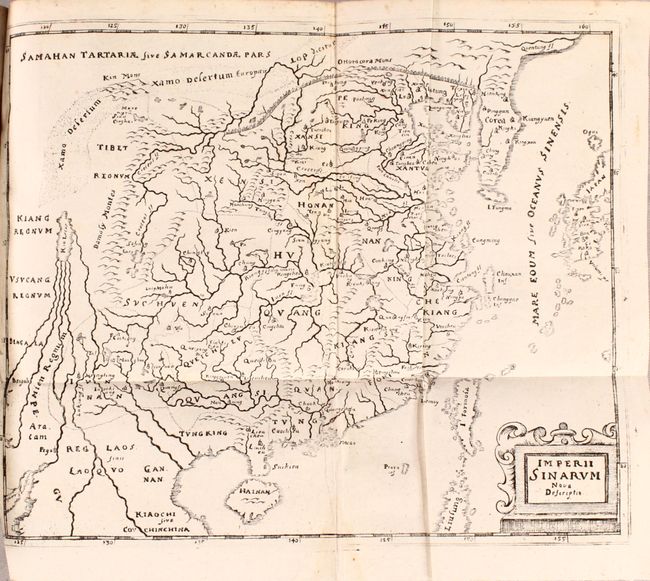
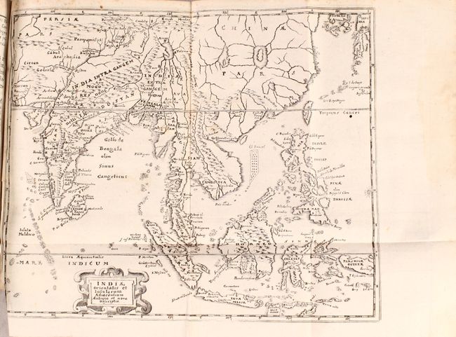
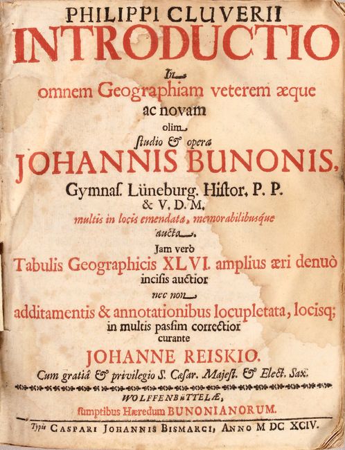
Cluver’s Introductio is considered the standard for 17th century geographical text books, as he is the father of modern historical geography. This edition of Cluver's geography was published in 1694 by the heirs of Johann Buno in Wolfenbuttel, Germany. There are 44 copper-plate engravings including the world map, maps of the continents (America, Africa, Asia, and Europe), and many regional maps within Europe, Asia and Africa.
The world map, Typus Orbis Terrarum (12.3 x 6.6"), depicts mid-seventeenth century geography with the partial shorelines of a large Terra Australis Incognita and the rudimentary beginning of an unnamed Australian continent. In North America, California is a peninsula with Quivera and Anian expanding the continent too far west. The map of America (9.8 x 8") was derived from the Nicolas Visscher map of 1658, with a Briggs type island of California and no Great Lakes in North America. The interior rivers of South America are all connected to a large, spurious lake labeled Lago de los Xarzyes. A depiction of the discoveries of Maarten Gerritsz de Vries' voyage appears in the waters north of Japan, and Abel Janszoon Tasman's discoveries are shown in New Zealand. The map of Africa, Africa, Antiqua, et Nova (10.2 x 8.4"), is an interesting continental map that is very similar to Sanson's Africa Vetus. Well engraved with few place names in the south and only the major river systems and mountains shown. The Nile originates from two large lakes well south of the Equator in the Ptolemaic style.
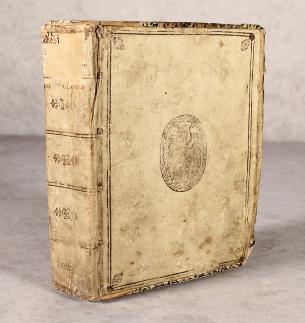
The Introductionis was published numerous times between 1624 and 1729 with each successive edition becoming more elaborate and the later editions including finely engraved maps. 608 pp. of Latin text plus extensive index. Octavo. Bound in an old, full vellum binding with embossed covers and spine that was repurposed from another slightly-smaller book, with the previous manuscript title on the spine partially obscured.
References: Betz #140; Burden #361; Davison & Kee #27; McLaughlin #25-2; Shirley #425; cf. Shirley (BL Atlases) T.CLUV-8a.
Condition:
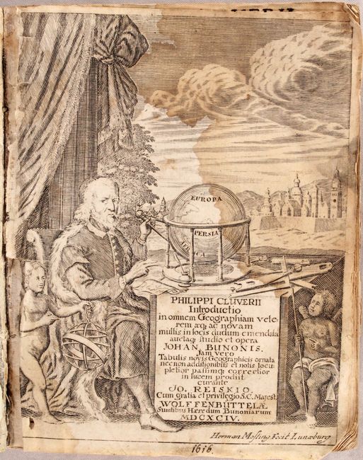
Most of the maps are in near fine (A) or very good (B+) condition, with some mis-folds, occasional soiling, and faint damp stains. Fewer than a quarter of the maps are in good (B) condition with more prominent damp stains, and the map of the Holy Land has a long tear. There are light damp stains scattered throughout the text, appearing quite prominently on the title page and frontispiece. The frontispiece is nearly detached but the binding is otherwise solid. The last page of the index is missing and the penultimate page is partially missing. The covers are soiled and worn and are slightly smaller than the volume, with a few small chips and tears in the corners and along the edge of the spine.