Subject: Western Hemisphere - America
Period: 1794 (dated)
Publication:
Color: Hand Color
Size:
47 x 20.4 inches
119.4 x 51.8 cm
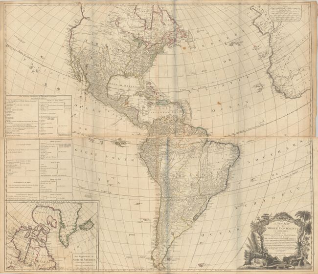
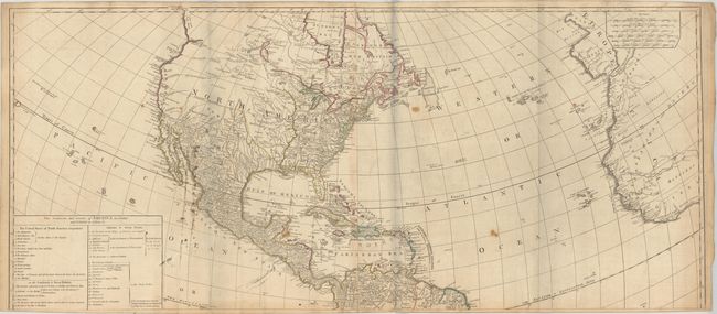
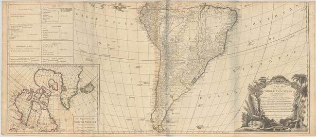
An impressive, four-sheet map of North and South America, originally drawn by John Gibson in 1763 with a slightly different title. The map went through several revisions, this being the final state. The huge map is filled with incredible detail and is based on D'Anville's cartography, as well as Spanish explorations on the west coast of North America and the journals of Governor Pownall in New England and Canada. The new United States is shown with its boundary on the Mississippi River. In the west are two possible locations for a River of the West: one with its source at Pike's Lake,, the other further north at Lake Winnipeg. A Chinese colony, Fou Sang, is shown in present-day British Columbia. At lower left is an inset map of Hudson and Baffin's Bay. Above the inset is a large text panel listing of the states and the colonial possessions of the various European powers. The baroque style title cartouche features a beaver, a crocodile, an Indian headdress amid trees, a waterfall, and tropical flora. This example is joined in two long, horizontal sheets, joining the two northern and the two southern sheets. If fully joined, the map would measure 46.5 x 40.7".
References: McGuirk #112; Stevens & Tree (MCC-39) #3f.
Condition: B
A crisp impression with contemporary outline color on watermarked paper. There is light toning, primarily along the edges and joints, and minor offsetting. On the upper two sheets, there are several light scattered stains and a 1.5" fold separation at bottom left that has been closed on verso with archival tape. There are grayish shadows along the folds that are caused by our scanner and do not appear on the maps themselves. The first image has been digitally merged together - the map is not fully joined.