Subject: Western Africa
Period: 1683 (published)
Publication: Geographise en Historise Werelt Beschryving
Color: Hand Color
Size:
12.1 x 6.5 inches
30.7 x 16.5 cm
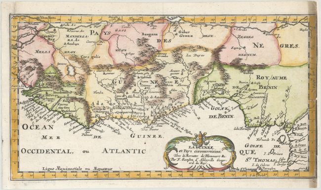
This attractive copper engraved map of the Guinea coast includes Guinea, Benin, and Congo. It is nicely detailed and decorated with a title cartouche that credits the information as being from Gerard Mercator and Samuel Blomaart, an African trader and West Indies Company director.
Sanson's small maps from his L'Afrique en Plusieurs Cartes..., first published in 1656 and engraved by A. Peyrounin, were copied several times by various map publishers. Johann David Zunners made copies of Sanson's maps for his German translation of Die Gantze Erd-Kugel in 1679. Johannes Ribbius and Simon de Vries published copies in 1682 and 1683, with new maps engraved by Antoine d'Winter. The plates were later sold to Francois Halma, who used them in 1699 and then again in 1705 with the titles re-engraved in Dutch. The titles on the d'Winter plates were re-engraved back into French, and then used by Nicholas Chemereau in 1715 and by Henri du Sauzet in 1738.
References: Pastoureau, SANSON I F bis.
Condition: B+
A crisp impression on a bright sheet with heavy soiling in the border at right. Remargined at right to accommodate framing, and binding holes in the left border have been reinforced with old paper on verso.