Catalog Archive
Auction 179, Lot 760

"Carte Particuliere des Isles Moluques", Bellin, Jacques Nicolas

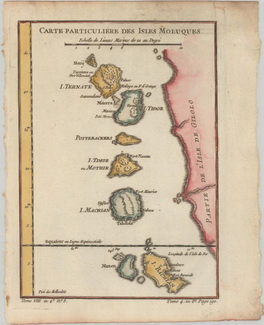
Subject: Maluku Islands, Indonesia

Period: 1780 (circa)

Publication: Histoire Generale des Voyages

Color: Hand Color

Size:
6.1 x 8.5 inches
15.5 x 21.6 cm
Download High Resolution Image
(or just click on image to launch the Zoom viewer)

This delicately engraved map represents the western coast of Irian Jaya and the Maluku Islands, the famous Spice Islands that were the cornerstone of the Dutch trading empire in the East Indies. The map locates the settlements and forts on each island.

References:

Condition: B+

A crisp impression on a bright sheet with light soiling in the image at top and a printer's crease in the right blank margin.

Estimate: $80 - $95

Sold for: $60

Closed on 9/16/2020

Archived