Subject: Japan & Korea
Period: 1681 (published)
Publication: Kurzer Begriff etlicher Relationen…
Color: Hand Color
Size:
12.3 x 8.3 inches
31.2 x 21.1 cm
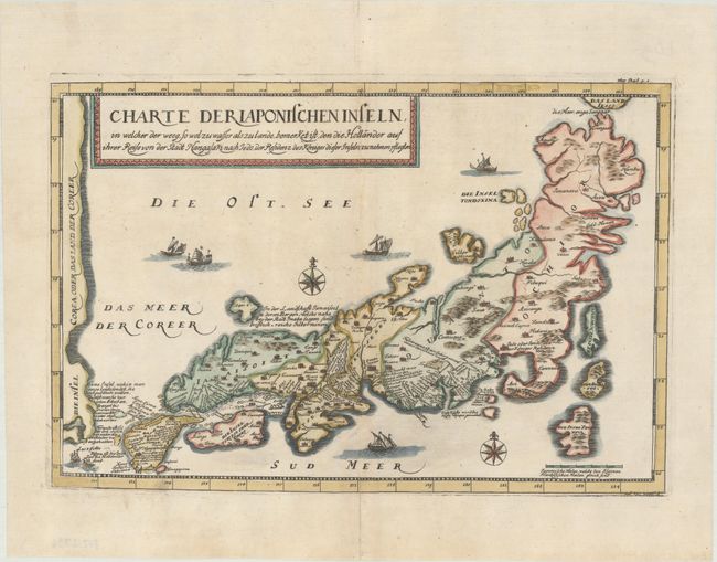
This is a very scarce map of Japan from an unauthorized German translation of Tavernier's work. The map is presented in the style of the Blancus/Moreira maps with eastern Japan being more pronounced than western Japan and an ungainly form of Honshu. The coast of Korea, noted as an island, forms the western edge of the map, and the sea between Korea and Japan is labeled Das Meer Der Coreer (Sea of Korea). The route of the Dutch East India Company to Edo is noted in the title and shown on the map, and Tavernier's famous notations are included. The handsome map is decorated with a variety of ships and a compass rose. Engraved by Johann Jacob Vogel.
References: Hubbard #49; Walter #OAG-46.
Condition: A
A crisp impression on a bright sheet with professionally repaired centerfold separations at top and bottom, just entering the map image at bottom.