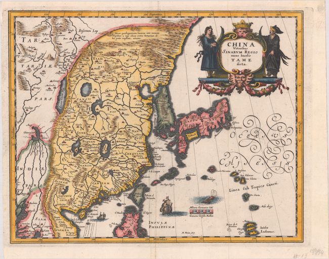
Subject: China, Korea & Japan
Period: 1658 (circa)
Publication:
Color: Hand Color
Size:
13.4 x 10.6 inches
34 x 26.9 cm
This elegant 17th century map of China, Korea and Japan is closely modeled on Jansson's map of 1633. The detail includes the eastern part of China (bounded in the west by the Great Wall), Korea as a strangely shaped island, and the three main islands of Japan. Taiwan is named Pakan al I. Formosa, although Tayoan is named on the island. The imaginary Chiamay Lacus is located in the southern region with five rivers flowing south into India and Siam. The map is decorated by a fine title cartouche flanked by Chinese figures, flourishing calligraphy, European and Chinese ships, and a sea monster.
References:
Condition: A
A superb, dark impression on a bright sheet, issued folding. Portions of the top and bottom margins have been folded behind the map to accommodate framing.