Subject: Northern Asia
Period: 1676 (circa)
Publication: A Prospect of the Most Famous Parts of the World…
Color: Black & White
Size:
20.1 x 15.4 inches
51.1 x 39.1 cm
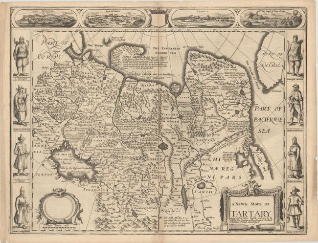
This splendid carte-a-figures map covers the region from Lake Baikal through the regions of present-day Manchuria and Siberia to the north of the Great Wall of China. Korea is shown as an island on the extreme right with parts of North America across the fabled Strait of Anian. The map is fully engraved with mountains and forests, numerous towns and fascinating notations. Included in the four views at top is a view of Nova Zembla, the winter quarters of Barents who searched for a northern passage between Russia and America. The other views depict important cities of the Silk Route - Astrakan, Samarkand and Cambalu. In the side panels are figures of the people of Tartary in their native costume. The English text on verso provides a fascinating contemporary description of the region. Imprint of Bassett and Chiswell in title cartouche with a blank dedication cartouche. Engraved by Dirck Gryp.
References: Shirley (BL Atlases) T.SPE-2f.
Condition: B+
A nice impression with light toning along the centerfold, minor foxing mostly confined to the blank margins, and some tiny chips and tears along the edges of the sheet.