Catalog Archive
Auction 179, Lot 696

"Perigrinatie oste Veertich-Iarige Reyse, der Kinderen Israels uyt Egipten, door de Roode-Zee...", Putte, I.
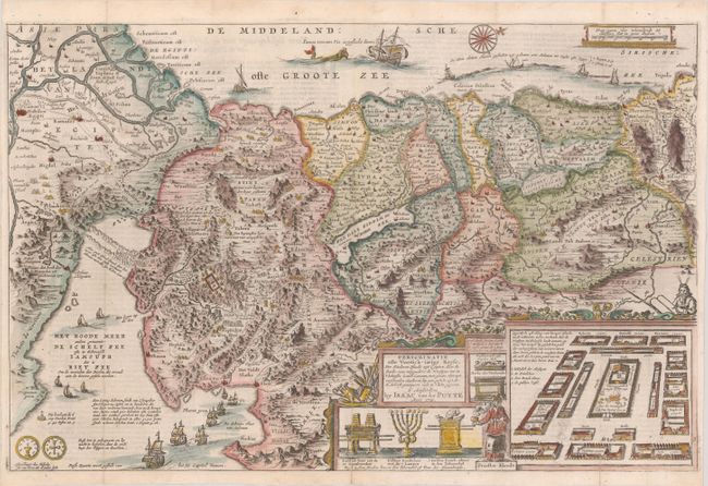
Subject: Holy Land

Period: 1715 (published)

Publication:

Color: Hand Color

Size:
18.8 x 12.3 inches
47.8 x 31.2 cm
Download High Resolution Image
(or just click on image to launch the Zoom viewer)

Lavishly decorated map of the Holy Land depicting the flight from Egypt. The Holy Land is divided among the tribes. The Kishon River connects the Mediterranean to the Sea of Galilee. There are numerous embellishments, including depictions of the encampment of the Children of Israel, temple vessels, Aaron & Moses, both sides of a shekel coin, a charming scene of Jonas and the whale, and several of Solomon's ships. This map was copied from Claes Janszoon Visscher's map of the same name. Published in a Dutch Bible, with text on verso.

References: Poortman & Augusteijn #172.

Condition: A

Issued folding on a bright sheet with archivally repaired fold separations at bottom.

Estimate: $275 - $350

Sold for: $450

Closed on 9/16/2020

Archived