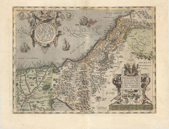
Subject: Holy Land
Period: 1598 (circa)
Publication: Theatrum Orbis Terrarum
Color: Hand Color
Size:
18 x 13.4 inches
45.7 x 34 cm
This is Ortelius' third map of the Holy Land. It covers the region from the Nile Delta to Lebanon, and focuses on the desert of the Exodus. Ortelius' map was based on Tilemanno Stella's map of 1557 that became the prototype for the modern cartography of the Holy Land. Stella adapted the coastline and Dead Sea from the configuration of Jacob Ziegler's map of 1532. But here, Ortelius rounds Stella's angular Dead Sea and the Gulf of Aqaba. The map is richly decorated with two elaborate, neoclassical cartouches. The sea is teaming with three ships, one of which is shown with canons firing. This example is from the third of three plates used for the Theatrum. Dutch text on verso, published between 1598-1613.
References: Nebenzahl (HL) pp. 84-86; Laor #539; Tooley (TMC-3) p. 28; Van den Broecke #172.
Condition: B+
A crisp impression with full contemporary color on a bright sheet with the crossed arrows watermark commonly found on Ortelius maps. There is a hint of toning along the centerfold, archivally repaired centerfold separations at top and bottom, and some printer's creases along the centerfold and at far left.