Subject: Gibraltar
Period: 1731 (circa)
Publication: Grosser Atlas uber die Gantze Welt…
Color: Hand Color
Size:
19 x 22.3 inches
48.3 x 56.6 cm
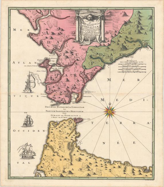
This extremely attractive map of the Strait of Gibraltar was a collaborative effort between Jean de Petit (royal engineer and architect) and Johann Friedrich Weidler (mathematician and astronomer at Witenberg). It was engraved by R.A. Schneider. The map covers the tips of southern Spain and northern Africa in great detail showing forts, cities, farms, mountains, local roads, and rivers. The numerous fortifications guarding this strategic waterway are the focus of the map, which is richly adorned with a brilliant compass rose, three large sailing ships, and a fine title cartouche depicted on an animal hide.
References:
Condition: A
A sharp impression with full contemporary color on watermarked paper with some minor toning along the centerfold and a hint of soiling.