Subject: Western Balkans
Period: 1697 (published)
Publication: Introductio in Universam Geographicam
Color: Hand Color
Size:
9.5 x 8.1 inches
24.1 x 20.6 cm
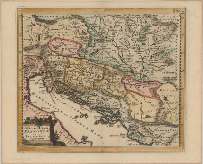
Attractive historical map of the Dalmatian coast from Italy to Greece. The map is based on Ortelius' map of the same title, which was based on Gastaldi's map of South East Europe (1560) and other information from ancient sources. Adorned with a classical title cartouche topped with colorful fruit.
Cluver's Introductio in Universam Geographicam was a popular atlas, appearing in over 45 editions during a 100-year period. The first edition was published without maps in the 1620s, and the first edition to include maps was published circa 1641. The various editions were published in different cities throughout Europe, including Amsterdam, Nuremberg, and London. This map is from an Amsterdam edition published by Jan Wolters.
References: Shirley (BL Atlases) T.CLUV-8a #23.
Condition: A
Light toning along the edges of the sheet.