Subject: Russia in Europe
Period: 1634 (published)
Publication: Novus Atlas
Color: Black & White
Size:
21.6 x 16.8 inches
54.9 x 42.7 cm
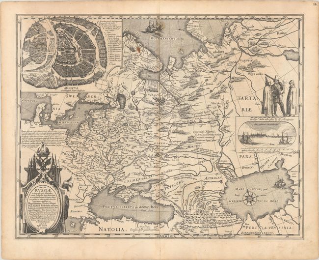
This is Blaeu's version of Hessel Gerritsz' rare and significant map of Russia, which he compiled from manuscripts brought back by Isaac Massa. The map covers the European part of the Russian Empire extending from Poland to the steppes of Tartary, and from the Mourmanskoy More (Barents Sea) to the Black and Caspian Seas. The large inset plan of Moscow is attributed to the Crown Prince Fydor Gudonov. The map is richly decorated with a large title cartouche, sailing ships, a compass rose, three Russian gentlemen, and an inset view of Archangel Sckagoroda. German text on verso.
References: Van der Krogt (Vol. II) #1800:2.2.
Condition: B+
A crisp impression with a light dampstain that just enters the map image at bottom, a couple rust spots, and light toning along the centerfold. There is a centerfold separation confined to the bottom blank margin.