Subject: Eastern Europe, Poland
Period: 1775 (circa)
Publication: Atlas Moderne
Color: Hand Color
Size:
17.6 x 11.9 inches
44.7 x 30.2 cm
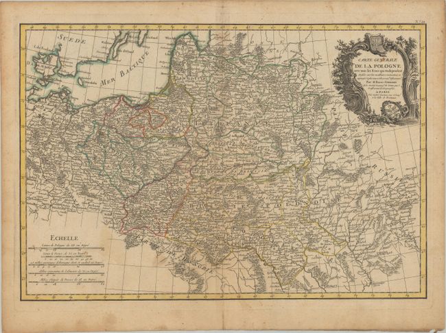
This very detailed map takes in the region of the Polish-Lithuanian Commonwealth, extending from the Baltic Sea and Denmark to part of Russia. It was prepared by Giovanni Antonio Rizzi Zannoni, one of the leading cartographers of the late 18th century. Rizzi Zannoni was the first to execute the triangulation of Poland, assisted in the French and English border survey of American in 1757, and served as the hydrographer of the French Dépot de Marine. This map was reduced from his large 12-sheet map of the Commonwealth and illustrates the region before the first Partition of Poland in 1772. The map is adorned with a lovely cartouche that incorporates the coats of arms of Prussia and Poland.
References:
Condition: B+
Contemporary outline color on watermarked paper with light toning and soiling.