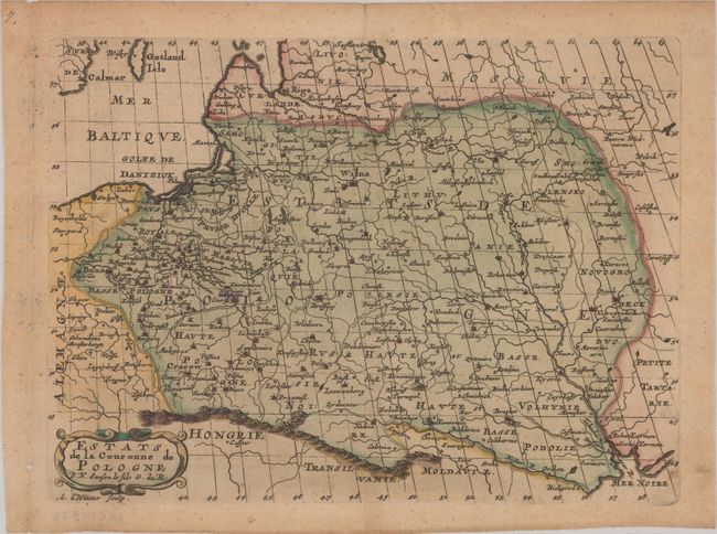
Subject: Eastern Europe, Poland
Period: 1683 (circa)
Publication:
Color: Hand Color
Size:
10.1 x 7.4 inches
25.7 x 18.8 cm
Detailed map covering the region of present-day Poland, Lithuania, Belarus and Ukraine, extending to the tip of the Black Sea. Political boundaries, towns, rivers, and mountains are well detailed. Adorned with a strapwork cartouche. Engraved by Antoine de Winter.
Sanson's small maps from his L'Europe..., first published in 1648 and engraved by A. Peyrounin, were copied several times by various map publishers. Johann David Zunners made copies of Sanson's maps for his German translation of Die Gantze Erd-Kugel in 1679. Johannes Ribbius and Simon de Vries published copies in 1682 and 1683, with new maps engraved by Antoine d'Winter. The plates were later sold to Francois Halma, who used them in 1699 and then again in 1705 with the titles re-engraved in Dutch. The titles on the d'Winter plates were re-engraved back into French, and then used by Nicholas Chemereau in 1715 and by Henri du Sauzet in 1738.
References: Pastoureau, SANSON VII F #7.
Condition: B+
A nice impression on paper with light toning, minor soiling, binding holes in the left blank margin, and a small worm hole in the right blank margin. Warsaw has been underlined in manuscript ink.