Catalog Archive
Auction 179, Lot 588

"Regni Poloniae et Ducatus Lithuaniae Voliniae, Podoliae Ucraniae Prussiae, Livoniae et Curlandiae Descriptio", Wit, Frederick de

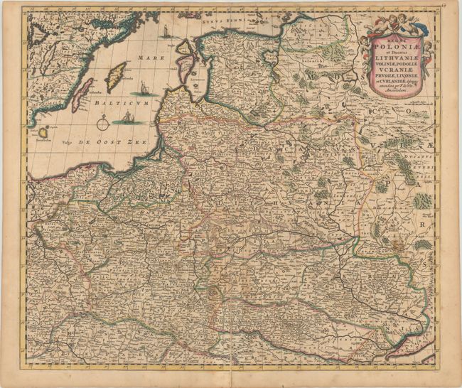
Subject: Eastern Europe & Baltic

Period: 1690 (circa)

Publication:

Color: Hand Color

Size:
22 x 19 inches
55.9 x 48.3 cm
Download High Resolution Image
(or just click on image to launch the Zoom viewer)

Finely engraved map of the region from the Baltic Sea (including part of southeastern Sweden) south to Austria and Hungary and east to include a bit of the Black sea. The map is filled with detail of hundreds of tiny villages, forests, marshes, mountains and rivers. The title cartouche is held aloft by a host of putti and tiny ships sail the Baltic.

References:

Condition: B

Scattered foxing with a 8" centerfold separation at bottom that has been closed on verso with old paper. There is some related light staining from the adhesive used to make the repair.

Estimate: $600 - $750

Sold for: $450

Closed on 9/16/2020

Archived