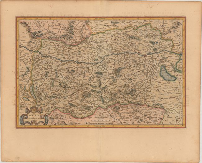
Subject: Austria
Period: 1619 (published)
Publication: Gerardi Mercatoris - Atlas sive Cosmographicae
Color: Hand Color
Size:
19.5 x 12.8 inches
49.5 x 32.5 cm
This densely engraved map of the Danube River valley is the first map of the region engraved for Mercator's Atlas. The map depicts numerous tiny villages, cities, mountains, forests and lakes. The Danube river flows across the center of the map, with Vienna at right. The map extends south to Graz and west past Linz, but not as far as Salzburg. A decorative strapwork cartouche and a simple distance scale grace the map. French text on verso.
References: Van der Krogt (Vol. I) #2710:1A.1.
Condition: B+
A nice impression with light toning and some marginal foxing. There is a short centerfold separation at bottom and a minor edge tear at right.