Subject: Switzerland
Period: 1848 (circa)
Publication:
Color: Hand Color
Size:
32.8 x 21.4 inches
83.3 x 54.4 cm
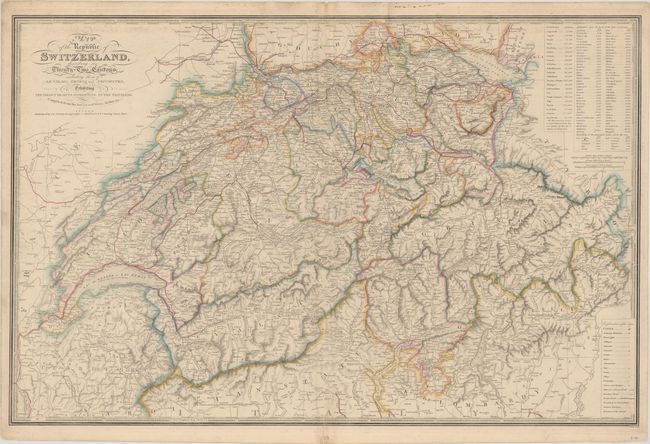
This intricately detailed map divides Switzerland into 22 cantons. It features excellent topographical detail of the country's mountains, lakes, and rivers. Tables at top right record the population for each canton, the altitudes of various locations, and the elevations of lakes above sea level. A key at bottom right identifies cities, small towns, villages, churches, castles, ruins, monuments, waterfalls, railroads, and more. There are three distance scales. Surrounded by a piano key border. Engraved by J. Walker.
References:
Condition: B+
Contemporary outline color on a sturdy sheet with light soiling at the top of the map image and a couple tiny abrasions near the centerfold. There are short centerfold separations at top and bottom that have been closed on verso with archival tape.