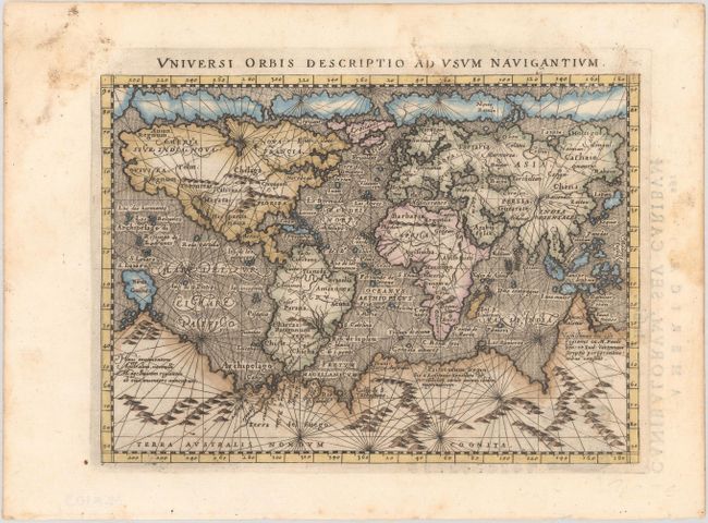
Subject: World
Period: 1596 (circa)
Publication: Geographiae Universae tum Veteris tum Novae…
Color: Hand Color
Size:
6.9 x 5 inches
17.5 x 12.7 cm
This small mariner's map is based on one of the most important world maps of the 16th century: Gerard Mercator's multi-sheet map of 1569. The map reflects the belief in wide Arctic sea passages and depicts a huge southern continent, to which Magini has added fanciful ranges of mountains. A fine network of rhumb lines crisscross the map, and the oceans are stipple engraved in the Italian style. This map, engraved by Girolamo Porro, is from an edition of Ptolemy's Geography that was edited by the distinguished Italian geographer Giovanni Magini. Latin text on verso.
References: Shirley #196; Mickwitz & Miekkavaara #223-64.
Condition: A
A dark impression on a bright sheet with marginal soiling and foxing.