Subject: Northern Ireland
Period: 1613 (circa)
Publication: Gerardi Mercatoris - Atlas sive Cosmographicae…
Color: Hand Color
Size:
14.9 x 13.6 inches
37.8 x 34.5 cm
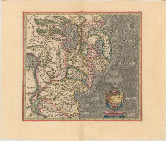
Superb early map covering Down and Antrim Counties in Northern Ireland. This was one of five Irish maps Gerard Mercator designed for the second part of his Atlas. It is beautifully engraved with a moiré pattern in the sea, strong topographical features in the interior, and ornamented with a title cartouche incorporating the distance scale. Latin text on verso, published between 1613-30.
References: Law, p. 21; Van der Krogt (Vol. I) #5941:1.1.
Condition: A
A crisp impression with full contemporary color on a bright sheet of watermarked paper with a hint of toning along the centerfold and a short centerfold separation in the bottom blank margin. There is paper tape along the top edge of the sheet on verso.