Catalog Archive
Auction 179, Lot 476

"Kent with Her Cities and Earles Described and Observed", Speed, John

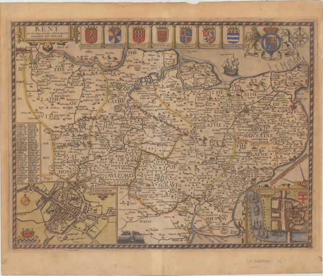
Subject: Southeastern England

Period: 1611 (circa)

Publication: The Theatre of the Empire of Great Britaine

Color: Hand Color

Size:
19.7 x 14.8 inches
50 x 37.6 cm
Download High Resolution Image
(or just click on image to launch the Zoom viewer)

This highly decorative map of Kent provides fascinating detail of the county, with London shown at the top left corner of the engraving. Inset plans of Canterbury and Rochester are included at bottom. A lovely border surrounds the map along with the royal crest, the arms of nine Earls, a compass rose, a sailing ship, and a battle scene. English text on verso.

References: cf. Shirley (BL Atlases) T.SPE-1a #26.

Condition: B

On a watermarked sheet with light toning and a 3.5" centerfold separation at bottom that has been closed with old paper on verso.

Estimate: $1,200 - $1,500

Unsold

Closed on 9/16/2020

Archived