Subject: Britain
Period: 1757 (dated)
Publication: Atlas Universel
Color: Hand Color
Size:
22.7 x 18.6 inches
57.7 x 47.2 cm
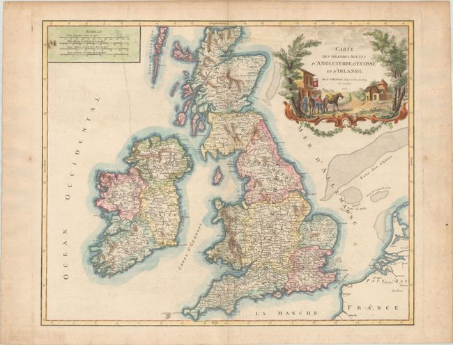
Handsome and detailed map of the mail roads through England, Scotland, and Ireland. The cartouche depicts a mail carrier mounting his horse outside a country inn. This is the third state of this decorative map with Bellfart corrected to Bellfast and a re-engraved cartouche by Groux. Dated 1757 but published in 1778.
Early maps rarely depicted roads and it was not until the middle of the 18th century that it became common for roads to be depicted cartographically. Increased road traffic and the development of formal postal systems spurred the production of maps that depicted roads. One specialized type of map that appeared in the 18th century consisted of highly detailed "post road maps." These maps showed incredible detail of the roads, stations (or stages), and the distances between them, as well as services available on the postal routes. Though many road maps were issued in the mail coach era, most were issued folded and they had a high rate of attrition due to hard use. The postal route maps issued in atlas format were less common at the time of publication, but are generally the ones that survive today.
References: Pedley #45.
Condition: B+
A nice impression on paper with a birdhouse watermark and vertical printer's creases at left and bottom center. There is light soiling and scattered foxing that is more concentrated in the blank margins.