Subject: Peru
Period: 1630 (published)
Publication: Nieuwe Wereldt ofte Beschrijvinghe van West-Indien…
Color: Hand Color
Size:
14.2 x 11.1 inches
36.1 x 28.2 cm
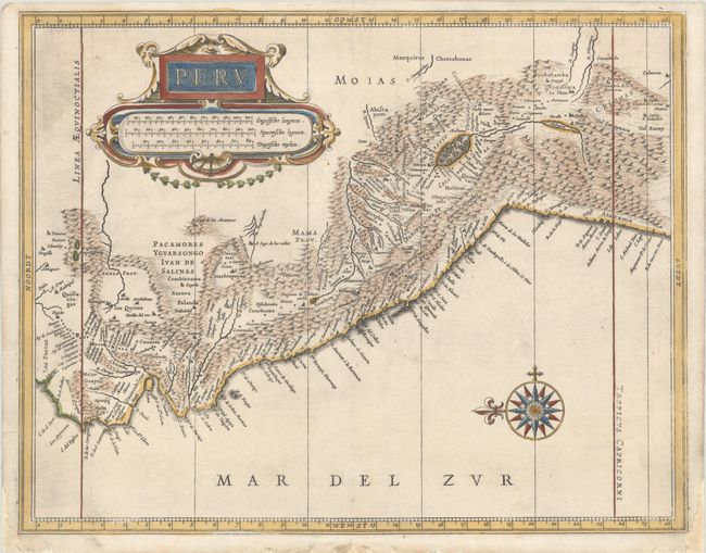
This great map is a foundation map for later Dutch maps of Peru. The map is the work of Hessel Gerritsz, one of the truly important Dutch cartographers of the 17th century. Most of his work was only done in manuscript and these maps, published by De Laet, are the only Gerritsz maps available to the collector today. The map vividly depicts the mountainous region and the large Lake Titicaca that is dotted with islands. A splendid strapwork title cartouche and compass rose adorn the map.
References: Shirley (BL Atlases) G.LAET-1b #8.
Condition: A
A dark impression on a sheet with a coat of arms watermark, a hint of offsetting, and some printer's ink residue at top left. There is some skilled professional paper restoration in the blank margins, not affecting map.