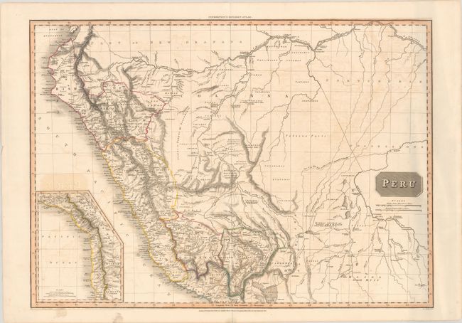
Subject: Peru & Brazil
Period: 1810 (dated)
Publication: A Modern Atlas
Color: Hand Color
Size:
27.7 x 19.8 inches
70.4 x 50.3 cm
This interesting map of Peru features nice topographical detail. Political division, place names, rivers, lakes, mountains, and more are shown in Peru. The portion of Brazil shown is labeled Portuguese Possessions. Numerous tribes are named, some with brief notes explaining their customs or relationship with the Spanish. A large swath of Brazil is identified as Unknown Parts. The course of the Beni River is traced with a dotted line with a note reading, "Course of the River Beni according to la Cruz & Amaramayu by Danville." An inset at bottom left depicts the stretch of coast to the south of Lake Titicaca, including portions of present-day Argentina, Bolivia, and Chile. Drawn by L. Hebert and engraved by Neele. Published by Cadell & Davies and Longman, Hurst, Rees, & Orme.
References:
Condition: B+
A crisp impression with contemporary color, light offsetting, minor soiling just entering the neatline at bottom left, and tiny centerfold separations in the top and bottom blank margins. There is some extraneous creasing at far right and a short tear in the right blank margin.