Subject: Colombia & Panama
Period: 1825-27 (published)
Publication: Atlas Universel
Color: Hand Color
Size:
22 x 18.2 inches
55.9 x 46.2 cm
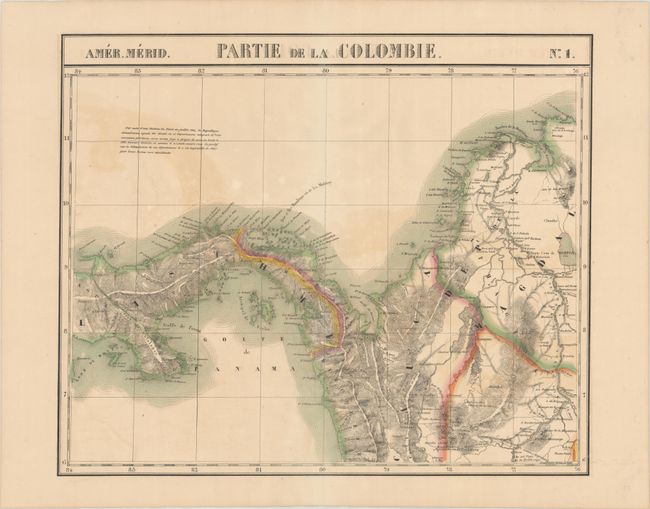
Vandermaelen was the son of a wealthy industrialist who abandoned his father's business to follow a career in cartography. His goal was to produce the first atlas ever published in which every map was drawn on the same projection and to the same scale (1: 1,641,836), with each map covering an area of approximately 20 degrees of longitude (from Paris) and 6 degrees of latitude. Because of the consistent scale and projection, the maps could be joined together to form a huge globe that would measure over 25 feet in diameter. Vandermaelen had the only known globe constructed from his maps, requiring a special room for its display. It was also the first lithographic atlas ever published. There was one edition of the atlas, published in 1825-27, and the subscription list shows that only 810 copies were sold. Koeman called his Atlas Universel, "One of the most remarkable world atlases ever made. Far ahead of its time."
This map focuses on eastern Panama and northern Colombia with excellent detail of the topography and rivers in the region. The note in the Gulf of Mexico explains that in July 1824 the Senate divided Columbia into 12 departments based on ancient divisions, but that no accurate information on the exact borders between the departments was available.
References:
Condition: B+
Con.temporary color on a bright sheet with light offsetting