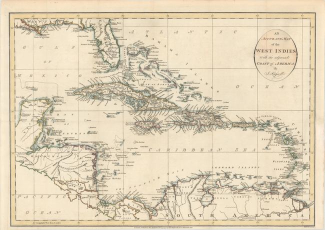
Subject: Caribbean
Period: 1794 (dated)
Publication: Am American Atlas…
Color: Hand Color
Size:
19.8 x 13.9 inches
50.3 x 35.3 cm
This detailed map of the Caribbean shows mountains, rivers, lakes, towns, bays, islands and shoals. The southern part of the United States, including Florida and the Mississippi Delta, is shown at the top. East and West Florida are depicted. This is one of nine maps engraved by Russell and published in John Reid's An American Atlas. The same nine maps were included in An Historical, Geographical, Commercial and Philosophical View of the American United States by William Winterbotham (1763-1829) published in London in 1795 and 1799 and in New York in 1796 (some maps by other engravers). Reid's An American Atlas was meant to accompany the version of Winterbotham's history published without the maps.
References: Phillips (Maps) p. 1059; Phillips (A) p. 751.
Condition: A
A crisp impression on a bright sheet, issued folding and now flattened with a hint of offsetting and archival repairs to a few tiny fold separations. A binding trim at right has been replaced, and an adjacent 1" binding tear has been archivally repaired.