Catalog Archive
Auction 179, Lot 371

"Le Vieux Mexique ou Nouvelle Espagne avec les Costes de la Floride Faisant Partie de l'Amerique Septentrionale", Fer, Nicolas de

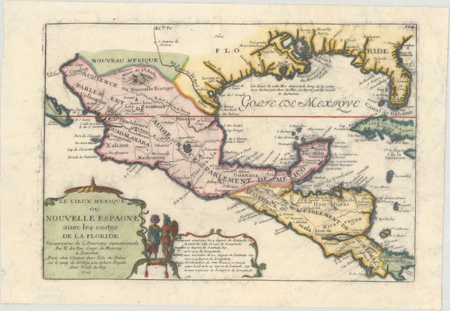
Subject: Gulf of Mexico & Cuba

Period: 1705 (dated)

Publication: L'Atlas Curieux ou le Monde…

Color: Hand Color

Size:
12.7 x 8.8 inches
32.3 x 22.4 cm
Download High Resolution Image
(or just click on image to launch the Zoom viewer)

This attractive small map covers the Gulf of Mexico through Central America and includes parts of Cuba and Jamaica. It extends through Mexico to show the southern tip of Baja California. This is an early map to show the correct location of the Mississippi River delta gleaned from the expeditions of La Salle and Iberville. Two French forts are located: LaSalle's Fort St. Louis in Texas (Fortbati en 1685) and another near present-day New Orleans. One of the prominent features in northern Mexico is Les Fameuses Mines de Ste. Barbe, the legendary Santa Barbara mines of the Chihuahua-Durango region. The large cartouche features two native figures.

References: Pastoureau, FER I [111]; Lowery #254.

Condition: B+

On watermarked paper with some light smudged ink throughout.

Estimate: $325 - $400

Sold for: $180

Closed on 9/16/2020

Archived