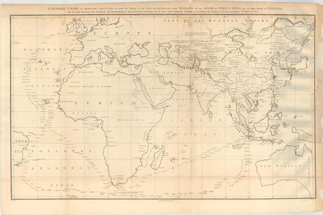
Subject: Eastern Hemisphere
Period: 1796 (dated)
Publication: An Authentic Account of an Embassy from the King of Great Britain…
Color: Black & White
Size:
37 x 22.4 inches
94 x 56.9 cm
This large chart was part of an account of George Macartney's travels to China. Macartney was Britain's first envoy to China, and was tasked with convincing emperor Emperor Qianlong to ease restrictions on trade between Great Britain and China by allowing the British to have a permanent embassy in the country.
The map shows the track of two ships, the Lion and Hindostan, on their routes from England to China and back. Each day's progress was recorded along the route along with several notations to the dangers along the way. The map was drawn by John Barrow, who was the private secretary to Lord Macartney. He was later Secretary to the Admiralty and was a vice-president and founding member of the Royal Geographical Society. Engraved by B. Baker and published by George Nicol.
References: Shirley (BL Atlases) G.BARR-1a #1.
Condition: B
Issued folding on thick "J Whatman 1794" watermarked paper with minor foxing, a few short fold separations that have been repaired on verso, and some dampstains at top. Several chips in the right blank margin have been replaced with heavy tissue.