Subject: United States, Mexico & Central America
Period: 1851 (dated)
Publication:
Color: Hand Color
Size:
24 x 23.5 inches
61 x 59.7 cm
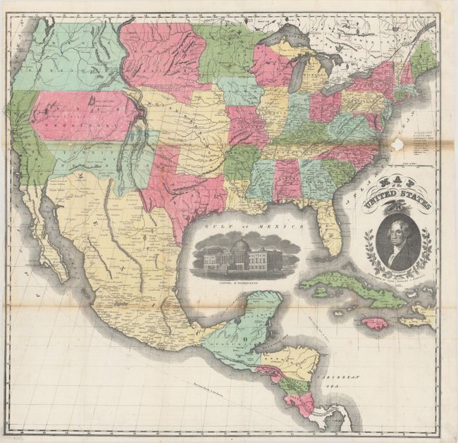
This scarce large-format map of the United States features striking insets of President Washington and a view of the Capitol of Washington. Its projection oddly distorts and foreshortens the western portion of the U.S. The very interesting territorial configurations include the pre-Gadsden Purchase border with Mexico and a large Oregon Territory occupying the entire Northwest and extending to the Continental Divide. Bordering Oregon is a huge Missouri Territory that extends east to an oversized Minnesota Territory at the Missouri River. The vast Indian Territory sits between Utah Territory, Missouri, and Missouri Territory. Utah and New Mexico are at their largest extent. In Utah, the Mormon Settlement appears at the Great Salt Lake. The map extends to include most of Central America and the western part of the West Indies.
References:
Condition: B
Issued folding and now flat with minor foxing, light toning along the top fold, and a few small fold separations that have been closed on verso with tissue. A small area of loss (0.75 x 0.75") in the Atlantic Ocean has also been backed with tissue and a 4" section of the left border has been replaced in facsimile.