Subject: Falls Church, Virginia
Period: 1878 (dated)
Publication: Atlas of Fifteen Miles Around Washington...
Color: Hand Color
Size:
24.6 x 15.5 inches
62.5 x 39.4 cm
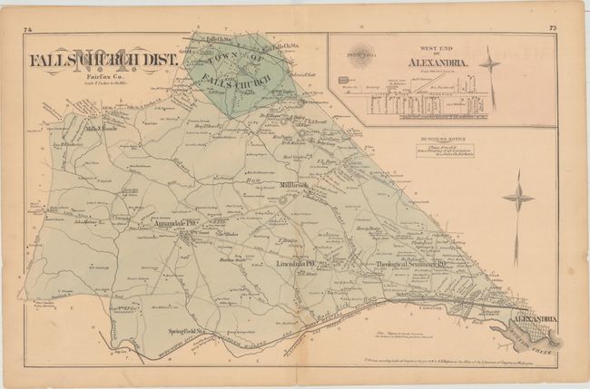
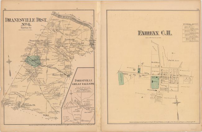
This detailed map shows the town and district of Falls Church, bounded by Guinea Road in the west, Leesburg Pike in the east, and a railway in the south that runs approximately along the present-day Capital Beltway Outer Loop. The map identifies roads, rivers and even property owners in the area. Numbers along the roads denote the distance in rods. An inset map shows a street plan of the west end of Alexandria, and the map includes an advertisement for Chas Arnold, a local house painter. On verso are maps of Dranesville District, the Forestville/Great Falls area, and a street plan of the area around the Fairfax court house.
References:
Condition: B+
Light soiling and toning that is more pronounced along the centerfold, with a short centerfold separation at bottom and a couple of tiny chips along the edges of the sheet.