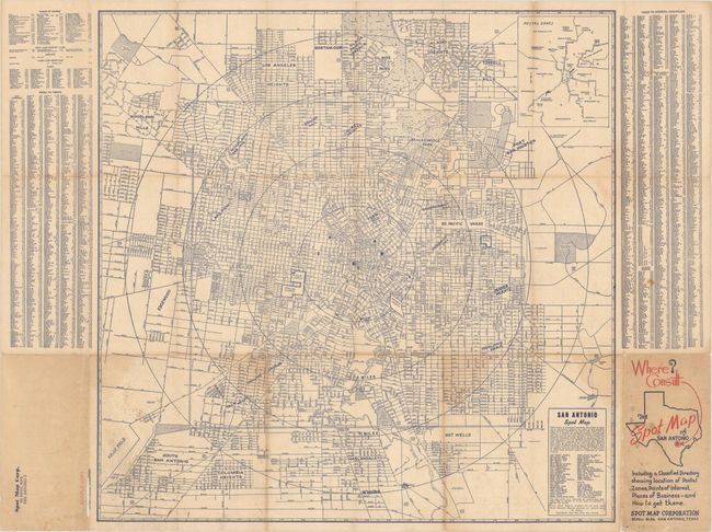
Subject: San Antonio, Texas
Period: 1941 (circa)
Publication:
Color: Printed Color
Size:
20.4 x 20.1 inches
51.8 x 51.1 cm
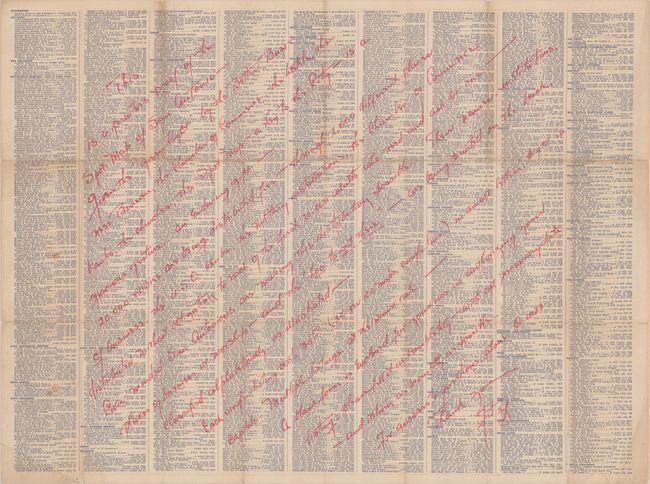
This rare map of San Antonio was published by the Spot Map Corporation. Printed in blue ink, 1 mile concentric circles extend a total of 4 miles out from downtown to include Columbia Heights, Los Angeles Heights, and Fort Sam Houston. Shows the street grid pattern, parks, golf courses, courts, rivers and more. Flanked by a street index and a comprehensive business listing on verso. Folds into paper wrappers (3.5 x 7.0") with title "Where? Consult The Spot Map of San Antonio with an arrow pointing to San Antonio on a map of Texas." Rear cover shows "Sample Copy."
A long manuscript note on verso states that: "This is a printer’s proof of the Spot Map of San Antonio – given the ‘green light’ by the Better Business Bureau…This Spot Map – a key to the City – is a gracious gesture and enduring gift. 20,000 copies are being distributed free…[cost for listing is $9 for each business]." There is no evidence, however, that this map was ever published with no sales history or institutional examples located on OCLC. The map was likely a victim of the war declaration in 1941 and never published.
References:
Condition: B
Issued folding with some light staining. There are numerous small fold separations with some minor image loss. Lengthy manuscript note covering the entire verso.